Next generation Technology for
ecosystem based marine management
uncovering vertebra richness of the
nordsea-skagerak-kattegat region
A new scientific platform has mapped marine
biodiversity across the Scandinavian sector of the Greater North Sea and found
major gaps between where marine life is concentrated and where protection
currently exists.
The results are based on more than 100,000 species
records combined with oceanographic data from the EU Copernicus Marine Service.
Using machine learning and neural-network modelling, the platform identifies
biodiversity patterns, key environmental drivers, and likely future shifts
across the North Sea-Skagerrak-Kattegat region.
The study covers 43 marine vertebrate species,
including fish, seabirds, and marine mammals, as well as broader richness models
for total, taxonomic, and functional biodiversity. Many of the species included
are sensitive, protected, or of high conservation value.
One of the clearest findings is that marine fronts
and currents strongly shape species richness. In several areas, the richest
biodiversity follows dynamic oceanographic features such as the Norwegian Trench
and the Swedish west coast. The models also identify clear temperature and
salinity thresholds linked to richness and assemblage structure.
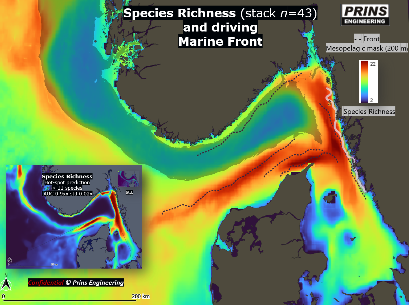
Figure 1. Predicted species richness from two
modelling approaches, showing broadly similar spatial patterns. Marine fronts
align closely with areas of elevated richness.
Just as importantly, major biodiversity hotspots
remain weakly protected or entirely outside current MPAs. In some places,
high-richness areas and strict protection overlap only partly, suggesting that
existing networks still fall short of an ecosystem-based design.
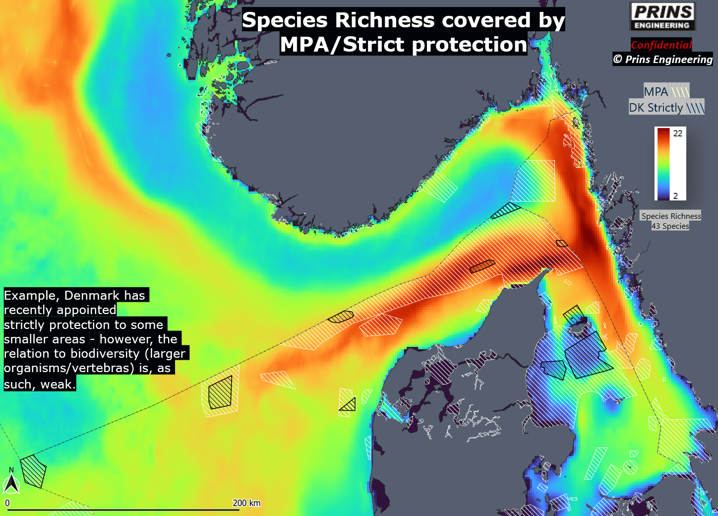
Figure 2. Predicted species richness with
existing MPAs overlaid. Danish strictly protected areas are shown with black
hatching.
This is especially relevant because EU and
regional frameworks, including the Marine Strategy Framework Directive, OSPAR,
and HELCOM, all call for coherent marine protection networks that reflect
ecological realities, not just administrative boundaries.
The study also points to climate-related change.
The models identify a clear temperature optimum for peak richness, and richness
is shifting toward deeper waters. That pattern is consistent with climate-driven
redistribution toward preferred thermal habitat and may reduce the effectiveness
of some present-day protected areas if species continue to move.
The platform can also be combined with fisheries
data. Early overlays with trawling intensity suggest that some strictly
protected areas in Denmark may have been placed where fishing conflict is
relatively low rather than where biodiversity value is highest. That does not
diminish their legal status, but it does underline the need for more
transparent, data-driven spatial planning.
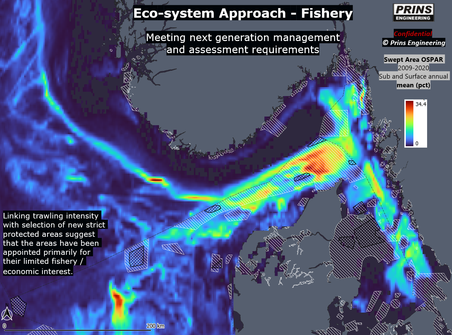
Figure 3. Average annual trawling swept-area
ratio (OSPAR, 2009-2020) overlaid with MPAs. Several Danish strictly protected
areas appear to avoid high trawling intensity rather than coincide with
biodiversity hotspots.
Overall, the work provides a ready-to-use
scientific basis for cross-border ecosystem management in the Scandinavian
Greater North Sea. It can support future negotiations, guide marine protected
area design, and help monitor ecological change as climate pressures intensify.
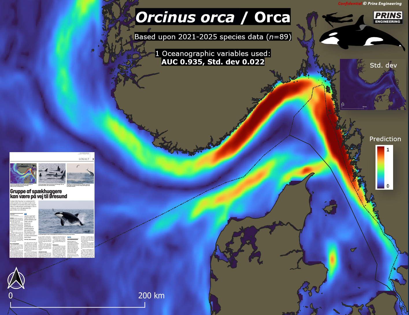
Figure 4. Orca occurrence predicted from one
derived oceanographic variable, the strongest predictor in the model.
The basic work has been
developed in connection with the EU Biodiversa+ Climate Invasives project
(2023-2026), where Prins Engineering leads the work on marine fronts and
biodiversity. The Climate Invasive work has been supported by Innovation Fund Denmark, and
preliminary results were presented to Danish stakeholders in early 2026.
The platform is under continuous development, and
can service most issues regarding the marine ecology
–
e.g., mechanisms
driving primary producers over time, alien invasive species hot-spots and
dispersal or specific species such as birds, fish or whales.



Client: EU
Funding: InnovationFund (DK), EU and Prins (>25%)
privacy2026@prins engineering.com