REMOTE SENSING
/ GIS BASED DECISION SUPPORT TO NATURA2000 HABITAT ASSESSMENT AND MAPPING IN
LITHUANIA
Assessment of Natura 2000
habitat classes is commonly based upon experts 'best' knowledge on distribution,
extent and quality. On a national scale, assessment of certain habitat classes
can be quite difficult - there will be no maps or statistics to lean on, thus,
assessment can easily be related to 'intelligent guessing'.
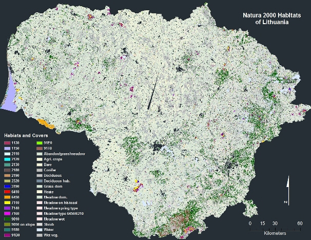
A combined scenario of 20
Natura 2000 habitat classes as well as other main cover types.
By the use of Earth
Observation and GIS techniques, it is possible to provide decision support to
experts to locate potential habitat areas as well as establishing an objective
basis for jugdment of the national extent. In Eastern Europe many of Natura2000
habitat classes can be sub-divided into classes related to 4' and 5' level of
CORINE which in many cases gives a better representation of eco-environment
driven by geo-botanical relation.
In Lithuania we used digital
remote sensing and GIS techniques to estimate the extent of more than twenty
Natura2000 habitat classes. National habitat specialists were involved in the
classification procedures by visual interpretation of classes, digitalization of
specific habitat areas, integration of existing field data and discussion on
criteria's for habitat mapping that should be modeled in GIS.
The analysis and simulation
of habitats include the use of national vector layers on forest, water courses,
bogs, land use and Digital Elevation Models.
The assessment of e.g. Taiga
was within few percent from what could be interpreted from national forest
statistics, overall the result was used to identify potential new habitat areas
and as such supported the assessment of actual extent.
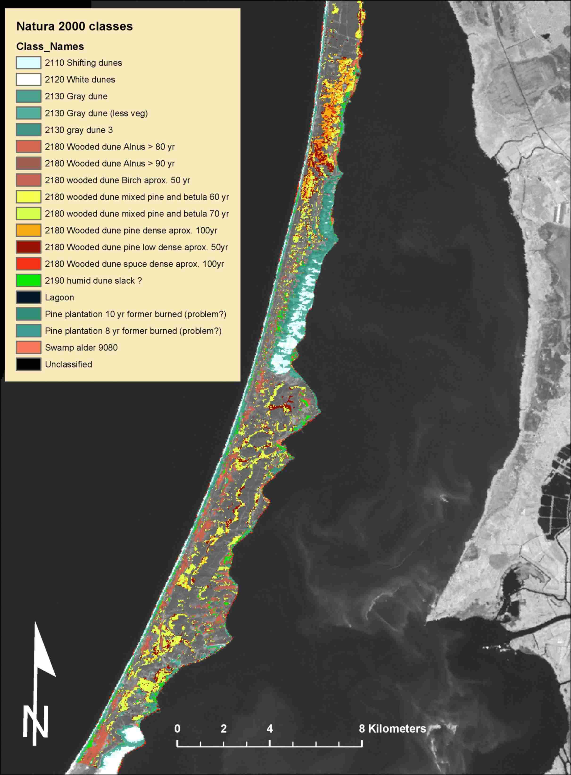
An example of Landsat based
Natura2000 classification of the UNESCO World Heritage Site- Curonian Spit. The
potential habitat area has been masked out and the veracity of single habitats
has to be merged.
Prins(2004): Decision support for
area estimation and area location of Natura 2000 habitats - based upon GIS
analysis of multitemporal Landsat data and digital land cover/use layers.
Project: ‘Implementation of Natura 2000 network on Regional and National
level in Lithuania.’
Prins, E,. Ciuplys, R and
Vaitkus, G: Using Landsat ETM and GIS to assess Natura 2000 habitats on a
national scale in Lithuania. (under prep.)
Client:
NepCon/DANCEE
privacy@prins engineering.com